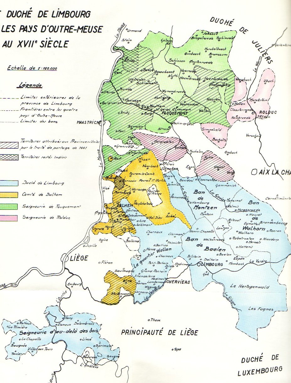
The lands of Overmaas / Outre-Meuse (17th century)
These lands became gradually property of the duke of Brabant in
the 11th - 14 th century.
(The Duchy of Limburg itself in 1288 after the battle of Woeringen).
The group of 4 territories:
the Duchy of Limburg
the County of Dalhem
the land of Valkenburg / Fauquemont
the land of Rode / Rolduc / Hertogenrade /
Herzogenrath
has (till the end of the 18th century) been administratively
combined under different names "the lands of Overmaas / Outre-Meuse", "Limburg
and the lands of Overmaas / Outre-Meuse", the "Province of Limburg"
etc.
After Brabant was finally divided between the Southern and Northern Netherlands
in 1648 (Treaty of Munster in Westphalia), these lands, East of the
river Meuse / Maas, were also divided between North and South ("partage"
in 1661; and major territorial exchanges
in 1785, traité de Fontainebleau).
The Duchy of Limburg itself was not affected with these territorial exercises.
scanned from the map in: Jacques
Thielens, Les assemblées d'états du Duché de Limbourg
et des Pays d'Outre-Meuse au XVIIe siècle, 1968, Namur, Ets. Godenne,
Anciens Pays et Assemblées d' ùEtats - Standen en Landen,
vol. XLIII, 150 pp + map