The picture is scanned from p. 37 in: Leo Wintgens, Grundlagen der Sprachgeschichte im Bereich des Herzogtums Limburg, Beitrag zur Studium der Sprachlandschaft zwischen Maas und Rhein, 1982, Grenz-Echo Verlag, Eupen, Ostbelgische Studien, Band I, ISBN 3-923099-11-8, xii + 525 pp.
Comments:
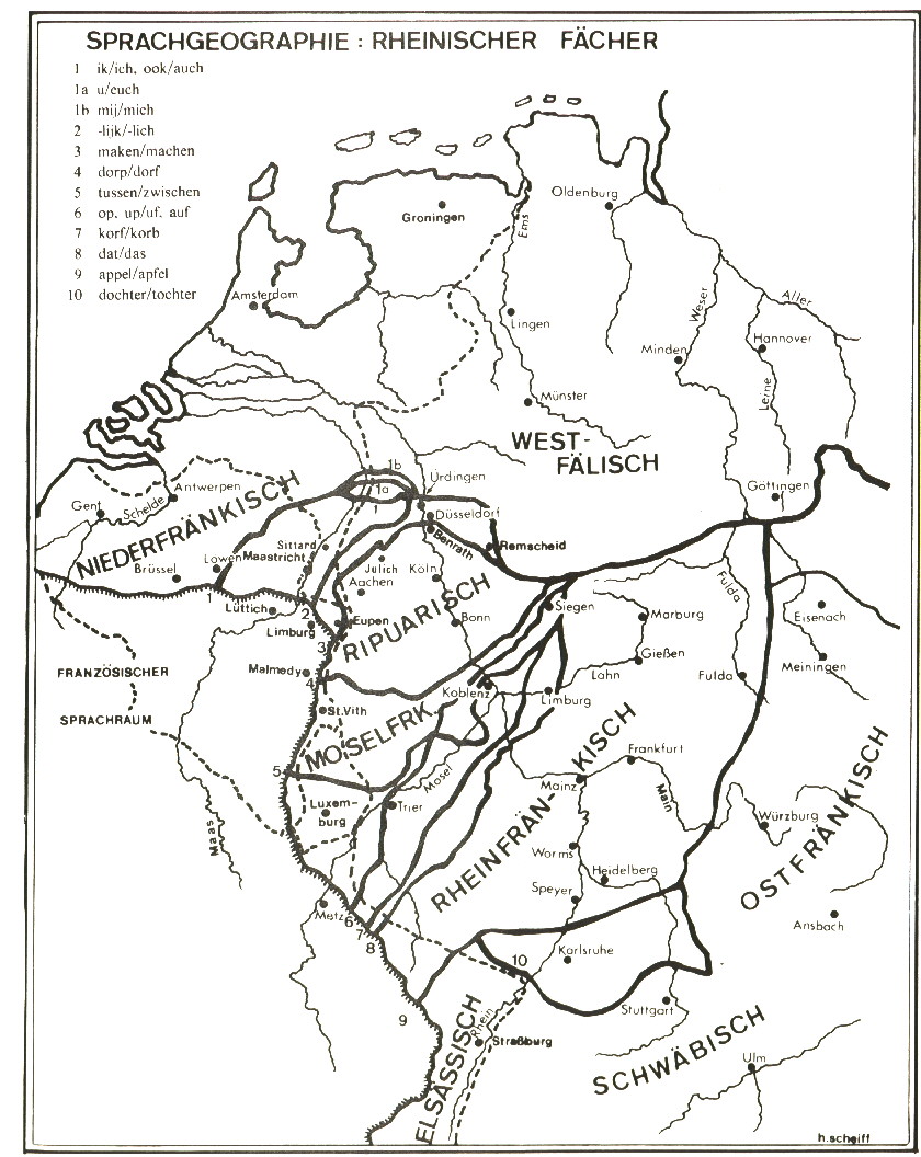
Limburg, just East of Lüttich (Liège) on the map, is
the Walloon town that gave it's name to the old duchy of Limburg. Do
not confuse it with the other town Limburg on the map (on the river Lahn)
The book by Wintgens deals with the language evolution in the linguistically
germanic part of the old duchy: the area around Eupen
Both cities, Limbourg and Eupen, are part nowadays of the Belgian province
of Liège.
Limburgish, as regional language though, usually refers to the language
variants spoken in the Belgian and Dutch provinces of Limburg. This area
is situated between isoglosses 1 and 3 on the map.
When the former French department of the Lower Maas (capital: Maastricht)
became a Dutch province in 1815, the Dutch king called it Limburg.
In 1839 this province was divided between Belgium and the Netherlands.
This page is created as illustration for our pages about languages spoken in Belgium
Some texts or pictures may be affected by copyrights and eventually need
to be removed from this server in the future
Created 2000-12-08, transfer to the Combell server on 2020-10-26
© Euro-Support, Inc.