

|
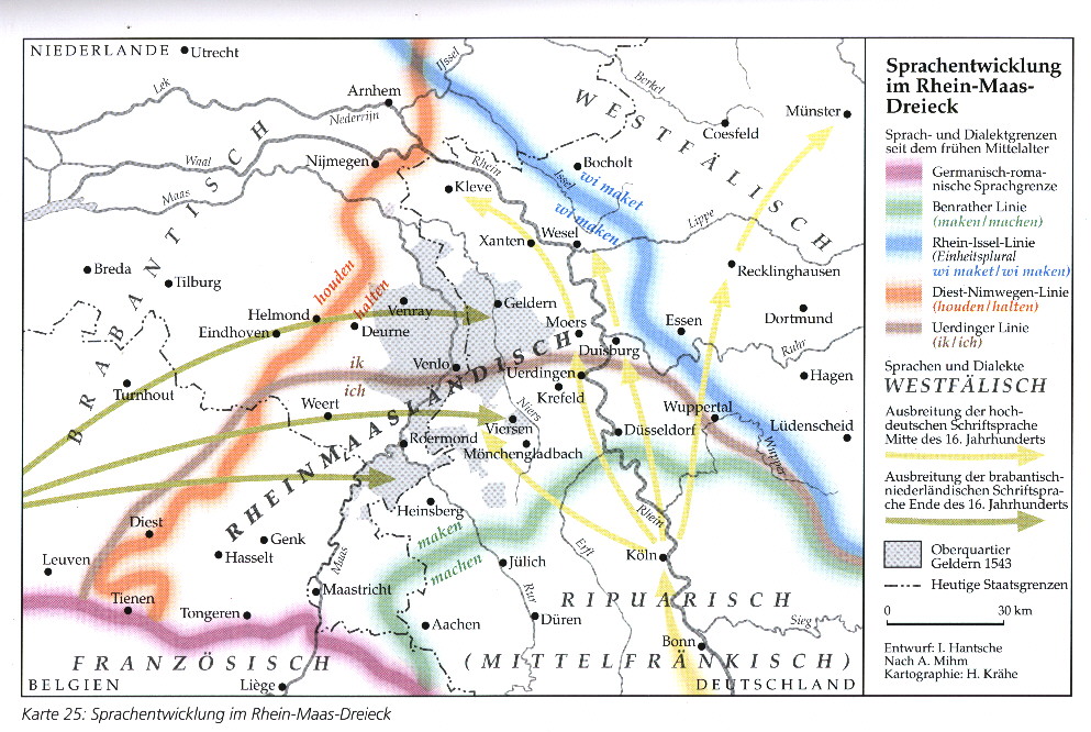
This map, combining the Kleverländish area with the South-Low-Franconian (Limburgish) area in tho "Rheinmaasländisch" is scanned from : Irmgard Hantsche, Atlas zur Geschichte des Niederrheins, Schriftenreihe der Niederrhein-Akademie, Band 4, 1999, Bottrop - Essen, Verlag Peter Pomp, ISBN 3-89355-200-6 and 3-89355-201-1 |