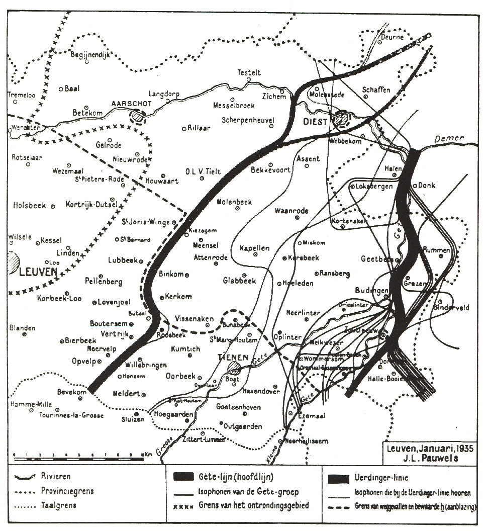
Several isophones coïncide with the Gete river, so this river is generally
considered to be more important than the Uerdinger isogloss (ik/ich) and
to form the real border between the Brabantish (West Low Franconian)
and Limburgish (East Low Franconian) dialect areas.
The first map is scanned from p. 223 in: G. Geerts, Voorlopers en varianten van het Nederlands, 1975, Leuven, Acco.
It originally comes from: p. 212 in Prof. Dr. J. Pauwels, Verzamelde
Opstellen, 1965, Assen, Van Gorcum, v + 219 pp + map;
This book, p. 208-217, contains a reprint of: De taal in het Hageland,
De Demervallei, 1935, Antwerpen, Vlaamse Toeristenbond (De Sikkel)
| The Uerdinger isogloss, ik-ich, from top right to bottom left on the map, links Diest with the North of Bevekom (Beauvechain), | The "Getelijn", N-S et the extreme right right on the map, links Halen with Halle-Booienhoven. The Gete river formerly separated the County of Loon from the Duchy of Brabant. |
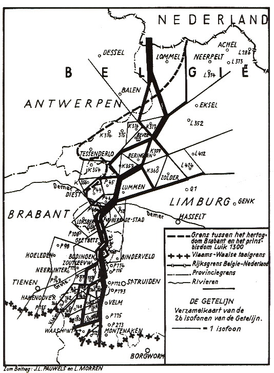
The second map is scanned from p. 224 in: G. Geerts, Voorlopers en varianten van het Nederlands, 1975, Leuven, Acco.
It originally comes from: J. L. Pauwels en L. Morren, De Grens tussen het Brabants en het Limburgs in België, Zs. Mundartforschung, vol. 27 (1960), p. 88-96 + map
This page is created as illustration for our pages about languages spoken in Belgium
Some texts or pictures may be affected by copyrights and eventually
need to be removed from this server in the future
Created 2000-01-06 / Corrected the links to the maps on 2004-03-22,
transferred to the Combell server on 2020-10-26
© EuroSupport, Inc.